Ficheiro:Satellite image of Israel in January 2003.jpg
Tamaño desta vista previa: 251 × 598 píxeles. Outras resolucións: 101 × 240 píxeles | 201 × 480 píxeles | 727 × 1.731 píxeles.
Ficheiro orixinal (727 × 1.731 píxeles; tamaño do ficheiro: 393 kB; tipo MIME: image/jpeg)
| Este ficheiro procede de Wikimedia Commons. A continuación móstrase a información da súa páxina de descrición. Commons é un repositorio libre de ficheiros multimedia. Pode contribuír alí cargando as súas imaxes. |
Resumo
| Descrición |
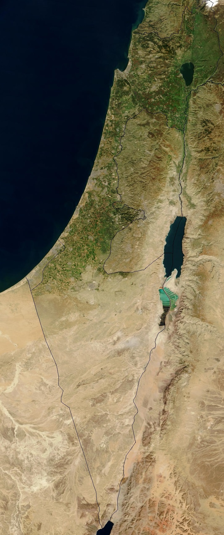
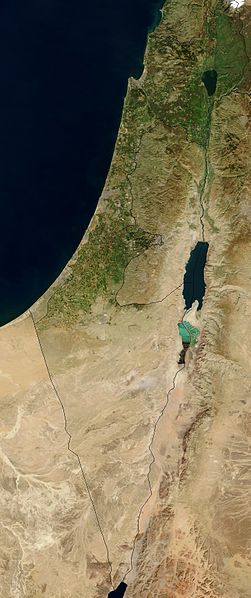
English: Satellite image of Israel in January 2003, with demarcation line overlay. The Green Line separating Israel and the West Bank is clearly visible.
Русский: Спутниковая карта Израиля (на январь 2003) с наложением демаркационных границ. Четко видна и Зеленая линия, разделяющая Израиль и Западный берег р. Иордан. |
| Data | |
| Orixe | Cropped from original: http://visibleearth.nasa.gov/view_rec.php?id=4969 |
| Autoría | Jacques Descloitres, MODIS Rapid Response Team, NASA/GSFC |
| Outras versións |
|

Licenza
| Este ficheiro está no dominio público porque foi creado pola NASA. A política do copyright da NASA declara que "o material da NASA non está protexido polos dereitos de autor a non ser que se indique o contrario". (Páxina de políticas do copyright da NASA ou política de uso de imaxes JPL). | ||
 |
Avisos:
|
Historial do ficheiro
Prema nunha data/hora para ver o ficheiro tal e como estaba nese momento.
| Data/Hora | Miniatura | Dimensións | Usuario | Comentario | |
|---|---|---|---|---|---|
| actual | 31 de xaneiro de 2015 ás 12:19 | | 727 × 1.731 (393 kB) | GregKaye | Cropped file to still include Gaza and Golan but with image centred more on the area of Israel |
| 4 de novembro de 2014 ás 17:38 |  | 1.441 × 1.738 (704 kB) | Chronus | {{Information |Description = Satellite image of Israel in January 2003, with demarcation line overlay. The Green Line separating Israel and the West Bank is clearly visible. |Source = Cropped from original: http://visible... | |
| 6 de novembro de 2013 ás 13:35 |  | 1.235 × 2.055 (393 kB) | Triggerhippie4 | ||
| 3 de setembro de 2008 ás 21:49 | 924 × 2.370 (355 kB) | Kriplozoik | {{Information |Description=Sattelite map of Israel as of January 2003 + scale |Source=http://visibleearth.nasa.gov/view_rec.php?id=4969 |Date=2003-01 |Author=Jacques Descloitres, MODIS Rapid Response Team, NASA/GSFC |Permission=see below |other_versions= | ||
| 3 de setembro de 2008 ás 21:30 | 924 × 2.370 (352 kB) | Kriplozoik | {{Information |Description=Sattelite map of Israel as of January 2003 + scale |Source=http://visibleearth.nasa.gov/view_rec.php?id=4969 |Date=2003-01 |Author=Jacques Descloitres, MODIS Rapid Response Team, NASA/GSFC |Permission=see below |other_versions= | ||
| 23 de decembro de 2004 ás 13:02 | 924 × 2.370 (349 kB) | Hautala | {{PD-USGov-NASA}} Satellite image of Israel in January 2003. Cropped image, original taken from NASA's Visible Earth http://visibleearth.nasa.gov/cgi-bin/viewrecord?24768 |
Uso do ficheiro
A seguinte páxina usa este ficheiro:
Uso global do ficheiro
Os seguintes wikis empregan esta imaxe:
- Uso en anp.wiki.x.io
- Uso en arc.wiki.x.io
- Uso en ar.wiki.x.io
- Uso en arz.wiki.x.io
- Uso en ast.wiki.x.io
- Uso en av.wiki.x.io
- Uso en azb.wiki.x.io
- Uso en az.wiki.x.io
- Uso en be.wiki.x.io
- Uso en bg.wiki.x.io
- Uso en bg.wiktionary.org
- Uso en bn.wiki.x.io
- Uso en br.wiki.x.io
- Uso en bxr.wiki.x.io
- Uso en ca.wiki.x.io
- Uso en ckb.wiki.x.io
- Uso en cs.wiki.x.io
- Uso en cv.wiki.x.io
- Uso en da.wiki.x.io
- Uso en de.wiki.x.io
- Uso en en.wiki.x.io
Ollar o uso global deste ficheiro.